MAPPING THE DISSONANCE
Why mapping?
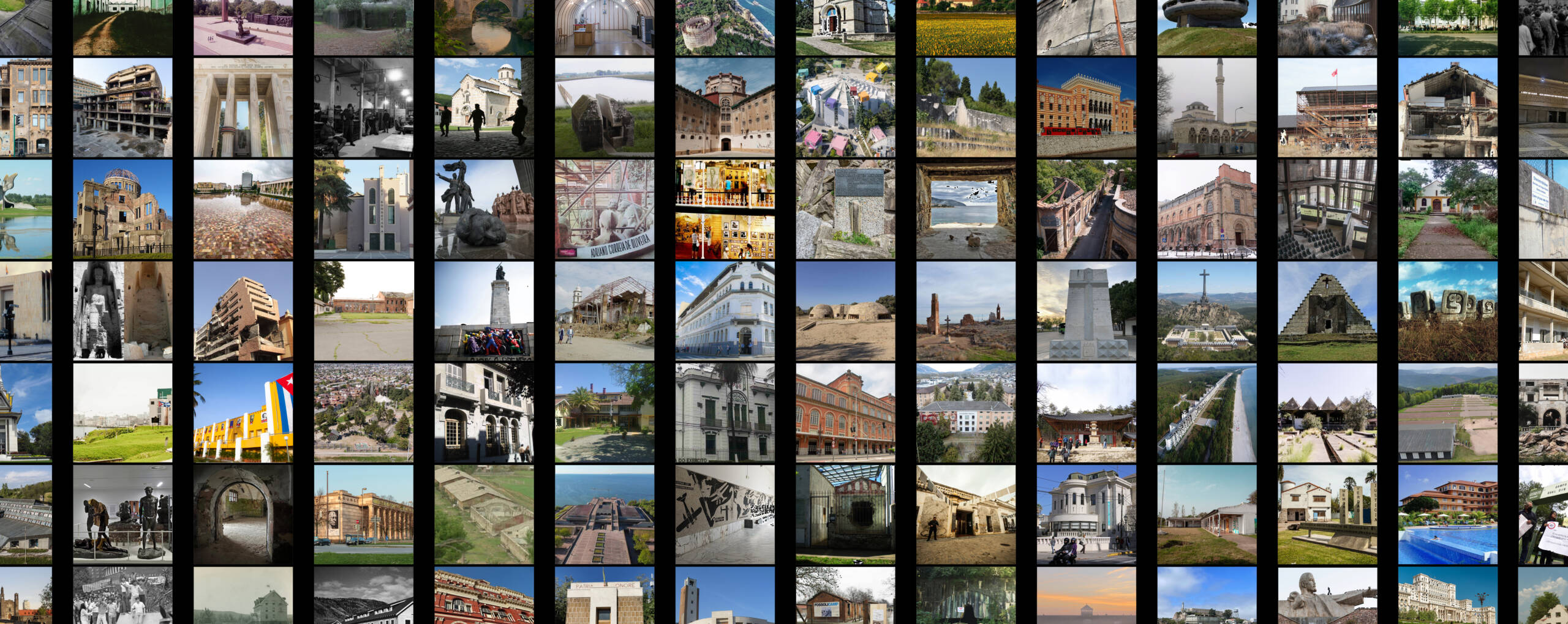
The aim of this mapping initiative is to deepen the understanding of dissonance and its specific manifestations across different regions of the world. By examining a substantial sample of cases, the resulting geo-app provides a comprehensive representation of dissonance phenomenon in architectural heritage, organized according to both geographical and semantic criteria. This interactive tool enables the investigation of dissonant heritage from a broad transnational perspective, the identification of patterns in the origins of dissonance and a wide-ranging screening of the strategies to manage it – serving as the backbone of the Co.Co.War project.
The mapping covers both European and non-European contexts. To date, approximately 130 cases have been documented, including sites undergoing re-signification, cases that have been effectively addressed, as well as cases for which strategies are still to be applied. Each entry provides information on where and when conflicts occurred, situates them within their historical contexts, and elucidates the underlying causes and consequences, with particular attention to practices for managing dissonance. This final repository constitutes a continuously expanding body of knowledge, integrating past experiences and innovative approaches to inform and guide future efforts in the conservation and communication of dissonant heritage.
The research is open to new contributions. Feedback, corrections, and contextual insights are warmly welcomed to enhance this strategic tool. Scholars, practitioners, and other stakeholders engaged in Dissonant Heritage Studies are invited to contribute to Co.Co.War mapping through the “Join the Map” section.
How to use the Geo-App?
To explore the map, we recommend switching to full-screen mode using the button at the bottom right. Navigate through the cases by clicking on the red points on the map to access information. The pop-up also includes a link to download an ID sheet for the selected case, summarizing key data and highlights.
Please note that all links in the geo-app and in the ID sheets were last verified during the most recent online access in January 2026.
Explore the map
Annotation: every effort has been made to identify and credit the copyright holders of the images used. In case of any unintentional omission or infringement, please contact us at cocowar.dissonant@gmail.com so that the necessary corrections can be made
Join the Mapping
We are continuously collecting new cases to advance the understanding of dissonant heritage, its diverse manifestations, and the strategies adopted worldwide. Please submit your contributions using the link or QR code below. Each submission will be carefully reviewed by the Co.Co.War team. Your input is highly valued!
Submit here or scan the QR code:
Atrium of congress hall on Nazi party rally grounds in Nürnberg 2012
Germany – Tuxyso